The Shape of the Landscape
If you look at books about the Pembrokeshire landscape, you will find that the vast majority of them deal with the spectacular coast, the Daugleddau and the Preseli Hills. It is these areas that are seen as exceptional. The parish of Lambston is not especially distinctive. It sits within an area of rolling hills, which extends from the coast to the west to the Treffgarne hills and their volcanic rocks in the east. The geology of the area tends to run west-east and the topography (The shape of the landform) in the parish runs in the same way. The parish is almost entirely set within the catchment of the Pelcomb Brook. This flows into the Cleddau, well to the east of the parish just below Crowhill Bridge.
Streams and Valleys
The deeper valleys (some rather steeper and deeper than their streams would cut one might think) run west-east. Numerous small streams flowing mainly north – south or south-north feed into them. Nowhere in the parish is more than about 500m from one of these small streams.
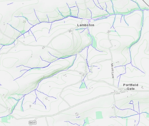
The general form of the land is made up by rolling, low hills. The highest point in the parish (On the Haven Road) is only about 99 metres above sea level. Slopes tend to be gentle and convex; the steepest slope is on the southern side of Sutton Mountain (79m). In South Pembrokeshire a number of low hills around 70m above sea level are rather grandly named “Something Mountain”. I wonder if this a relic of the Fleming influence? In the Netherlands and Flanders I believe that there are jokes about hills being called mountains. Does anyone know the truth of this?
Views
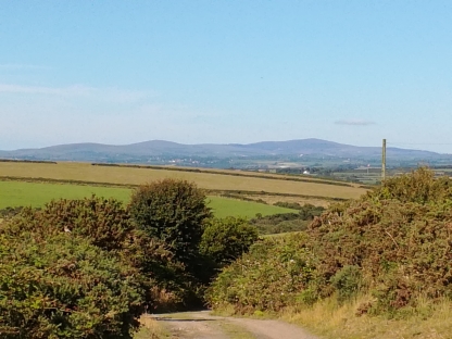
The views, when you have them, tend to be dominated by numerous shades of green, with big skies. Views to the north-east can be spectacular. From the north-facing gardens of houses in Portfield Gate and from Sutton Mountain, you can see the Preseli Hills. Round to the north and much closer, are the volcanic rocks of Plumstone Mountain and Treffgarne Rocks. From the top of Plash lane you can, rather unexpectedly, see Pen Beri on the St Davids Peninsula.
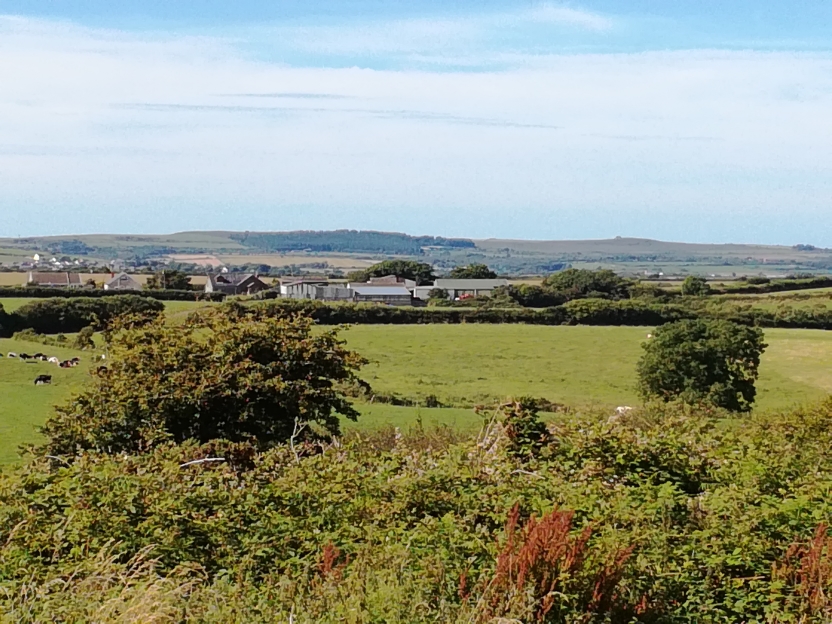
Many of the lanes are sunk deeply into the landscape between high hedges so that views across the landscape tend to be through gateways or from high points such as the Haven Road and Sutton Mountain. Portfield Gate and Lambston are on fairly high points and stand out, Sutton is almost hidden in folds in the landscape.
Land Use
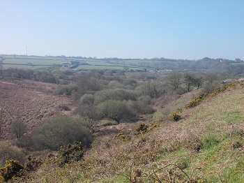
The land is mainly improved farmland with a mixture of pastoral and arable farming occupying well over 90% of the land area. There is an un-grazed common in the south west part of the parish. This is gradually becoming covered in scrubland and, in parts, is on its way to wood.
Established woodland is unusual in the parish with only two small named woods on maps. Lambston Wood, felled and replanted in the 1980s and East Hook Wood. There are also significant areas of land, especially along the river banks where scrub encroachment is developing. These, together with hedgerow trees, can give a wooded appearance to parts of the parish which is misleading.
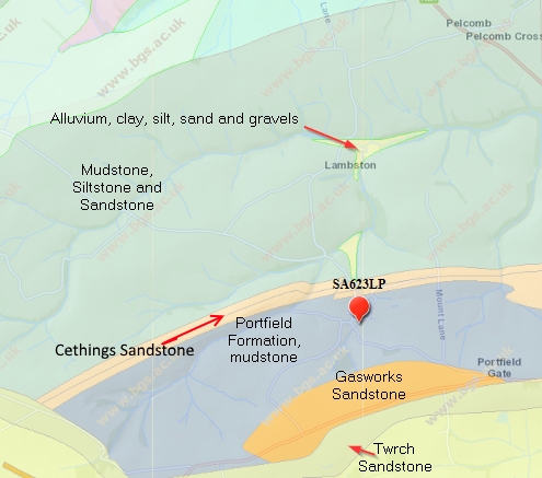
Geology
The geology of the area runs in bands SSE to NNW across the parish. The majority of the soil has developed either on mudstones or on shales but there is a narrow band of very hard sandstone across the middle of the parish, right along the south flank of Sutton Mountain, through Bramble Hall land and up Mount Lane. There is also an area of sandstone forming the higher ground around Portfield Gate.
More detail on geology of the parish is on the next page