Changes in Farms in the parish 1840-1941
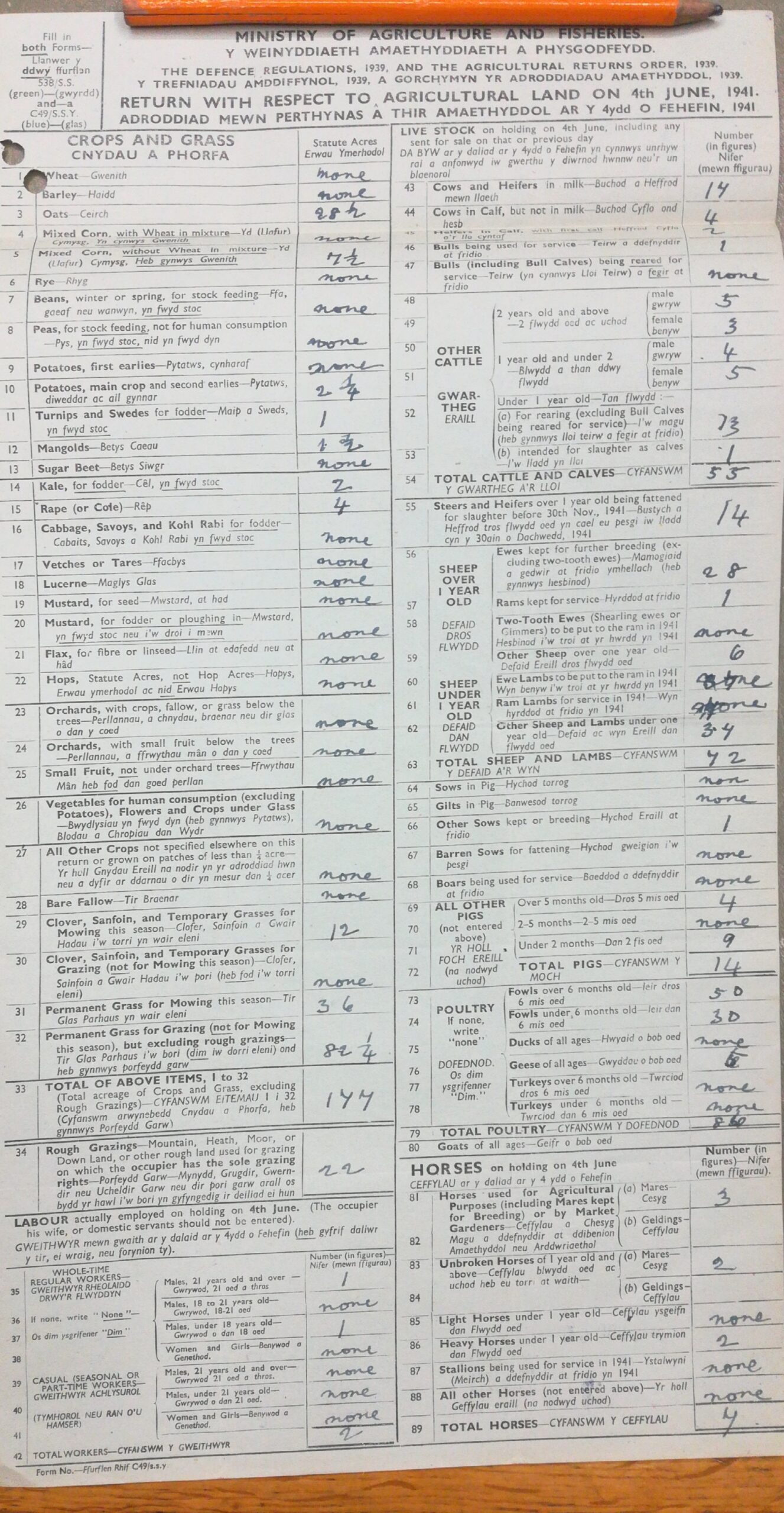
The two most complete records that we have of farming and land use across the parish are the Tithe Maps of 1840 and the Agricultural Returns compiled during the second World War in 1941-1942.
Of the 28 farms and holdings listed in 1840, there were 20 left in 1941. No land seems to have been abandoned, but farms have merged together. In one or two cases farms were also split into new units.
The main farm mergers were in Sutton with 7 farms or parts of 7 farms being combined into Westhill Fold. (Four unnamed farms in Sutton village plus Sutton Farm, Lammack and Margam).
Little E Hook became part of East Hook, Lambston Hill was incorporated into Lambston Hall.
Giberalter became part of a new holding at Upper Honey Hook.
The farmstead at Black Patch was lost. But Fairview, a new farm situated on the opposite side of the road was created, farming different land.
West Lambston was split two ways (Three really because the Fairview land was largely West Lambston) to include Homeland and Lambston West.
Tenanted or owner occupied land
In 1840 there were 27 farms in tenancies and only three farms shown as owner-occupied. (Providence land farmed from Portfield Gate, The Glebe and Honey Hook). The Glebe land, however in the name of the vicar was presumably really owned by the church.
In 194110.5 of the farms were occupied by tenants and 10.5 were owner- occupied.