The network today
The parish sits in a wedge between the Haverfordwest – St Davids road to the north and the Broadhaven road to the south. The busiest lane runs from Portfield Gate roughly west to Nolton with an offshoot to the north towards East Hook (Mount Lane). Another passes up Lambston Hill to Lambston and Pelcomb Cross. In Sutton village a staggered crossroads sees a lane leading south up to the Broad Haven road (Plash Lane). Off that is a dead-end spur up to Sutton Mountain and Gabriel. Another lane runs out of the north east of the village to Mount Lane.
Early records
There are surprisingly few records of the development of the minor road and lanes in Pembrokeshire. The 17th and 18th century county maps generally do not show roads. Any that do, only show the Haverfordwest-St Davids road. Later maps that purport to show road layouts usually only show the Dale and St Davids roads to the west of Haverfordwest. The first map that I can find that shows the present road layout are the 1810 Ordnance Survey drawings. But even after this date, maps that look as though they show the layout of principal roads often omit the road to Broad Haven from Haverfordwest. However there must have been lanes from early times to service the settlements at Sutton, Lambston & Walesland (13th century). The church at Lambston would surely have required a track to bring in stone.
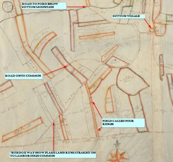
The earliest map, which shows roads within the body of the parish dates from 1762. Unfortunately this map only covers the Sutton part of the parish. It would be good to have a similar map for Lambston and East Hook. It clearly shows that the back lane from Sutton village to Mount Lane was not then in existence. Strip fields run right across the line of the lane. There is however a track shown between the strip fields on the map which looks as though it has been ‘fossilised’ in the sharp bends between Margam View and the Bramble Hall Drive.
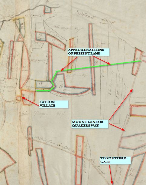
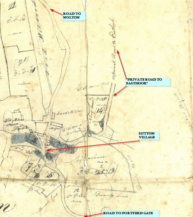
In 1818, on the Evanton Estate map, this lane does appear on its present course but is labelled as ‘Private road to Easthook’.
Road Atlas maps
Eighteenth century road atlases showing the St Davids road from Haverfordwest show an odd piece of information. The strip maps only show road junctions with the destination of the minor road.
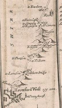
At Pelcomb Cross the road to the west is correctly labelled as to Dunston. At Pelcomb Bridge however the joining road is labelled to Lambston. This appears to be the present lane which passes Slade Hall and comes to the north west of Haverfordwest. This would have been a very odd way to reach Lambston. Could there have been another road here now lost? Was there at that time no link from Dunston to Lambston? Or is it simply a cartographic error? If the latter, it is repeated on numerous versions of the road atlas, no doubt each copied from earlier draftsmen. (incidentally does anyone know anything about “Faire Castle” shown west of Simpson Cross? Was it Hilton Court?)
Plash Lane
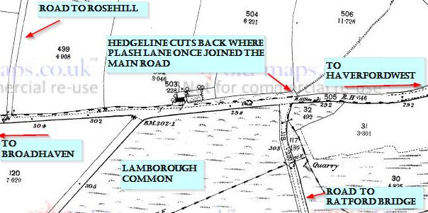
The 1762 Picton Estate map shows that Plash Lane at that time, did not have a right angle bend on it. The lane continued straight across the fields to meet the Broadhaven road. This junction is still visible on the ground today as the fence-line cuts back from the present road to allow for a long-gone junction. This would once have been on the edge of Lamborough Common. This is confirmed by an eighteenth century conveyance referring to Plash Lane as ‘The lane from Sutton to Lamborough Gate’
At some time between 1762 and 1810 (the first edition OS surveyor’s drawings), the lane was diverted, probably up a narrow strip field called (in 1762) ‘Four Ridges’ to its present route.
Sutton Mountain
The earliest maps, the PIcton Estate map (1762) and the OS surveyor’s drawings (1810) show no tracks at all and no dwellings on Sutton Mountain. No lane is shown up the mountain. The present lane appears to end at the ford. On the tithe map in 1840 again, no lane is shown beyond the ford. However a gap between enclosures north of Berry Hill and south of Sutton West (Modern names) suggests that there must have been a track of some sort in 1840.
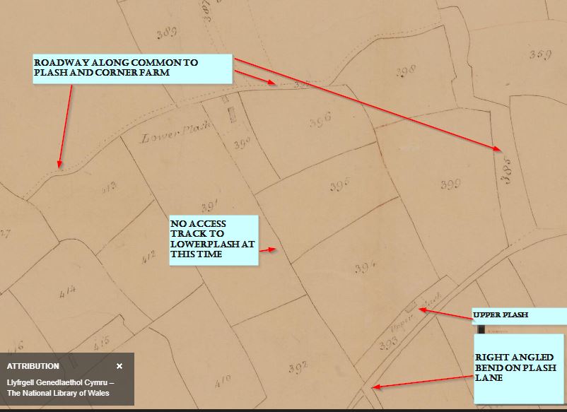
A roadway is shown and named, running from Plash Lane, south west of Gabriel onto the common. It then runs along the south side of the common to Plash and Corner Farm (Then known as Haythog Back). Today this is not even a footpath. It was the only access shown to Lower Plash and Haythog Back (Corner Farm).