Mills in Lambston
For most of our history, farming was focussed mainly on providing food for the immediate neighbourhood. Most parishes would have needed a mill for grinding locally grown corn. I have found records of several, perhaps as many as four, mills in the parish although there is only a certain location for one.
Nineteenth Century – Lambston Mill
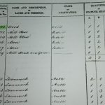
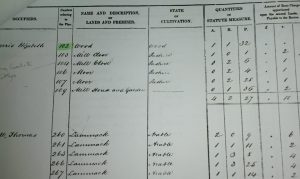
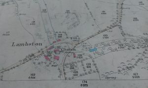
Lambston Mill is shown on the 1840 tithe map and mentioned in the 1841 and 1851 censuses. The buildings are shown as outlines (probably ruined) on the 1887 1:1250 Ordnance Survey map. It is not shown on the 1818 first edition OS one inch map, suggesting it was a fairly recent addition or an error on the OS.
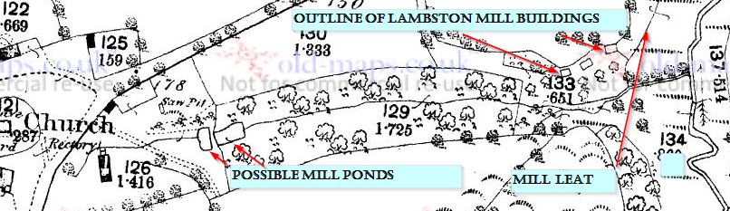
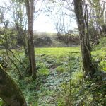
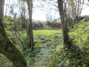
This mill used a very small tributary stream, no more than 300m long above the mill. There are two ponds, or the remains of them, left and the sides of the watercourse look man-made. I assume that the water was ponded up and then released when needed. Even so I would think there would be fairly little head of water.
The leat to Lambston Mill
Having viewed the site courtesy of the John Family of Lambston Hall. I then heard from David Thomas whose uncle farmed at West Lambston in the 1950s and 60s. David recalls traces of a mill leat running from Walesland Water to the mill site and crossing the Lambston to Pelcomb road. Knowing this, I was then able to find the line of the leat on the 1889 O.S. map. Perhaps this leat augmented the water supply to Lambston Mill.
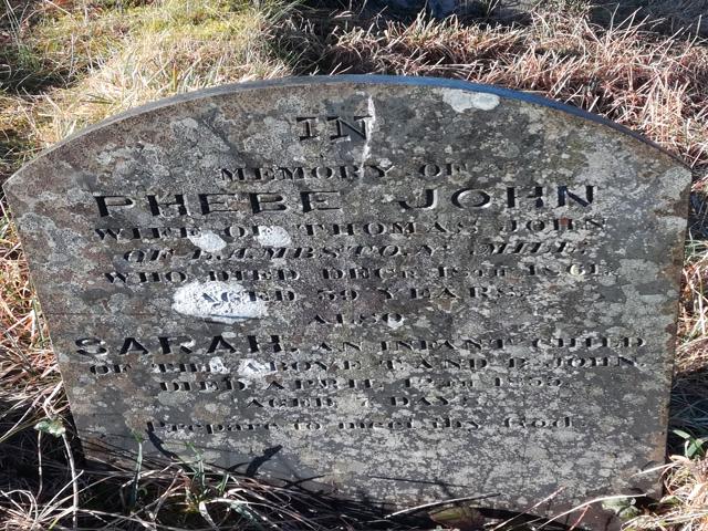
One odd thing about Lambston Mill is that the buildings are shown perhaps 30 m away from the stream, uphill. The mill must have closed between 1840 and 1887 (In the 1861 census there is mention of a family living at the mill but the occupation is not given as ‘miller’. There is a gravestone in the parish churchyard to Phebe John, wife of Thomas John of Lambston Mill who died in 1861.
There seems no mention of the closure of the mill in any newspaper or other record.