Names of places have changed over time. One of the best sources to find out about place names is the work of B G Charles ‘Pembrokeshire Place Names’. I have drawn on his records but also used numerous original sources which would not have been available to him.
The earliest names seem to date from the 13th century but this may be because written records become more available at that time rather than because these farms were founded then. Having said that, the Flemish settlement dates from this time so there may well have been new settlement or re-naming of old settlements. No doubt there were also welsh settlements that pre-dated the Flemings but their names seem completely lost.
Starting in the North-West corner of the parish and just looking at the farms which exist today .
Honey Hook – first mentioned 1383;
Today there are two farmsteads – Upper and Lower Honey Hook. Until the mid-nineteenth century there was only the lower farm at the end of the track. The Tithe Map and the 1818 Ordnance Survey map show this as Honeyhook. If we go back in time the name changes to Hony Hoke in 1793 and Honyhok(e) in 1383. (The authority on Pembrokeshire Place Names B G Charles says it is a place of sweet pasture or where bees were kept.
Upper Honey Hook appears for the first time on the 1886 OS Survey and there is a reference in the census in 1851 to a shoemaker living at Honeyhook Hill – could this be an early name for Upper Honey Hook?
Walesland – first mentioned perhaps in 1392;
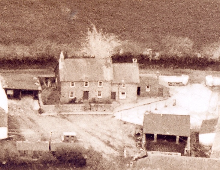
This is not a separate farm today but has a very varied name history. It appears on the 1818-19 OS map as Wasling Farm and on the 1840 Tithe Map as Waseland. On a legal document in 1821 it was Waesland. On a map of Wales (Below) using 14th century records it is recorded as Walslonde and has been variously Walsland, Walsland alias Walls in the 17th century, Waseland in 1659. Even earlier there is a record of Le Walles in 1392 possibly meaning ‘land by the walls’ – perhaps suggesting an earlier occupation? (B.G. Charles).
I am wary of questioning Mr Charles but I wonder if Waesland could be the last remnant of a Flemish name – there was a province of that name in Flanders in the 13th century and even today it is locally pronounced as though it was spelt ‘Waesland’.
Lambston;
In earlier documents the farms in the village do not seem to have a separate farm name, so Lambston Hall is often shown as simply Lambston. B G Charles tracks the name back to back to tax records in 1291 as Villa Lamberti. It seems likely that Lambert or Lambertus was a Flemish personal name. Although there are lots of early histories who see Lambston as firmly Scandinavian. I am not clear which came first – the Farm, the church, or the Village but logically that seems the likely order.
B G Charles records the name as Lamberteston in 1321 and in 1392 as Lambertyston. In the 15th and 16th century we have Lamburston and Lamerston (e). On Owen’s map in 1602 it is shortened to Lamston. It is often unclear if the names are referring to the farm, the village or the parish. LINK to parish Name page.
Lambston Hall
Lambston Hall historically would have been one of the more important homes in the parish. In 1762 it was occupied by William Wheeler Bowen who was Mayor of Haverfordwest. The farm name changed through time. At various times it was called ‘Lambston Farm’ (1871, 1881), ‘East Lambston’ or ‘Lambston East’ (1841 and 1916), ‘Great Lambston’ (1906 and 7). ‘Lambston Hall’ ; the present name was also used in 1824.
There seems to have been only one major farm in the Lambston hamlet, for as long as I can find records. Though of course there was also West Lambston, as a significant holding, plus a number of much smaller holdings; Lambston Hill, Lambston Glebe.
East Hook;
East Hook is another old name with first records from 1497 of Easthoke. It has gained and lost an ‘e’ on the end and regularly changed from one to two words. In the 14th, 16th and 18th centuries it was referred to in numerous documents as Nestehoke, Neste Hook, Neastehoke and Nesshooke. B G Charles attributes this as follows ” The development of the initial N in the forms was due to the common mis-division of Middle English atten est hoke ‘at the east hook’.
Again I hesitate to raise a query and have no expertise. However even given the tendency to copy manuscripts from each other it seems unlikely that a mistake would be perpetrated over 3 centuries. Often in documents signed by the owner of the land. It also interests me that the Flemish for ‘Corner’ is Hoek. In Lambston we have two ‘Hook’ names in the north east and north west corners of the parish.
The Tithe Map in 1840 shows Great East Hook (On the present farm site). Also Little East Hook (now an abandoned site to the north east).
There are also references to a fifteenth century West Hook but I have no idea of its location.
The East Hook B&B website has a great deal of interesting historical information on East Hook at http://www.easthookfarmhouse.co.uk/history.html
New Park
As its name suggests New Park is a much more recent farm appearing on OS maps in 1975 for the first time.
Corner Farm
This farm has had a really complete name change. Corner Farm as a name seems to arrive between 1840 and 1887. On the Tithe map it was called Haythog Back. However by 1887 the six inch O.S. map shows it as Corner Farm. The first recorded reference from B G Charles is in 1773 on a Picton Estate map as ‘Heath hog back’, but I think this was a field name rather than a farm name.
Westhill Fold Farm
West Hill Fold in Sutton also seems fairly modern name, though for a much older farm. The 1818-19 O.S. map and the Tithe Map in 1840 shows two sets of farm buildings at this location. However typically, for farms in villages, they are not named.
Farm legal documents provided by David Marr of Westhill Fold Farm do not refer to the farm by that name before the mid 19th century. However there was clearly a farm here in the eighteenth century if not earlier. It looks to me as if land of the farm was built up by James Eaton-Evans. he made a series of acquisitions in the second half of the nineteenth century.
Westhill Fold – a new farmhouse and new name in the Nineteenth century
The County Archive has an undated drawing of an unnamed house associated with James Eaton Evans from the mid-nineteenth century. It looks very like Westhill Fold Farmhouse. I have seen deeds that confirm that the land at this farm was owned by James Eaton Evans in 1862.

A series of conveyances in the 18th century refer to a holding in the same area as Vawdland or possibly Nawdland. This is name I have not managed to find anywhere else. From a comparison of deeds it was probably a single field stretching from Plash Lane to the Haven road.
There are lots more name changes – this is a site under construction and under research. So as I find out more I will add it. If you have any queries that I may be able to help with, please let me know. If you have any documents relating to Lambston that you I could see, please let me know. Especially farm lease documents or conveyances for property in the parish. They are a valuable source of information that can be found nowhere else.