“Main” Roads
The B 4341 (Haven Road) through Portfield Gate perhaps surprisingly does not form the southern parish boundary. Originally it principally went to Walton West and Little Haven rather to Broad Haven. But there is a narrow strip of the parish along the south side of the road which has always (as far as we know) been part of Lambston. Perhaps this reflects early ‘informal’ intakes of land from the Poorfield Common which used to extend as far as Temperness Lane. In the early part of the twentieth century the area of Temperness was also incorporated into the parish. Previously it had been a detached part of Haverfordwest St Thomas.
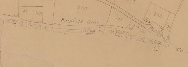
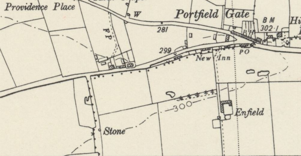
There are fairly few named roads or lanes in the parish. The “main” road from Portfield Gate through Sutton does not seem to have a name on the Ordnance Survey maps. The 1840 map that accompanied the Portfield Enclosure Award showed it, sensibly enough, as Sutton Road. Whether it was still known as Sutton Road on the Nolton side of Sutton, I don’t know. In the censuses of 1841 and 1851 cottages which appear to be on the road from Sutton to Nolton roughly where Cleavlands is today are called ‘Lambston Lane’.
Mount Lane or Quakers Way
The lane from Providence to the Quaker Burial Ground was named as Mount Lane on nineteenth century O.S. maps. On the 1889 OS map, the hill where the Friends Burial Ground is set was shown as ‘The Mount’. The burial ground itself is sometimes referred to as ‘The Mount Burial Ground’. The name clearly predated the present house on this site but there was a house called ‘The Mount’ to the west of the lane opposite the entrance to the burial ground. This was shown on the 1889 OS map and was named in the 1891 census but recorded as unoccupied. It had gone by the 1907 OS edition. It must have had a short life because it was not mentioned in the 1881 census nor shown on the 1840 tithe map.
The earliest map which showed this lane was the 1762 Picton Estate Map. Surprisingly perhaps, it was not called ‘Mount Lane’ on this map. It was clearly labelled as ‘Quakers Way’, a name not found on any other documents as far as I know. MAP
Plash Lane or Burdox Way
On the west side of Sutton, the lane up to the Broad Haven road past Westfold Farm is generally shown as Plash Lane. The name refers to the farmstead of Plash (On some OS Maps shown as Lower Ash) which is now ruined and dominated by a rusty dutch barn. The tithe map in 1840 shows both Upper and Lower Plash, the former being close to the road at the right angle bend. There seems no trace on the ground of Upper Plash today. I had assumed that ‘Plash’ was to do with hedge laying or ‘Plashing’. However B.G. Charles, the authority on Pembrokeshire Place names, gives its origin as ‘Plaesc’ a boggy or marshy place.
An estate map of 1818 shows the lane as ‘Little Haven Road’. This perhaps reflected that at that time Little Haven was a much more prominent settlement than Broad Haven.
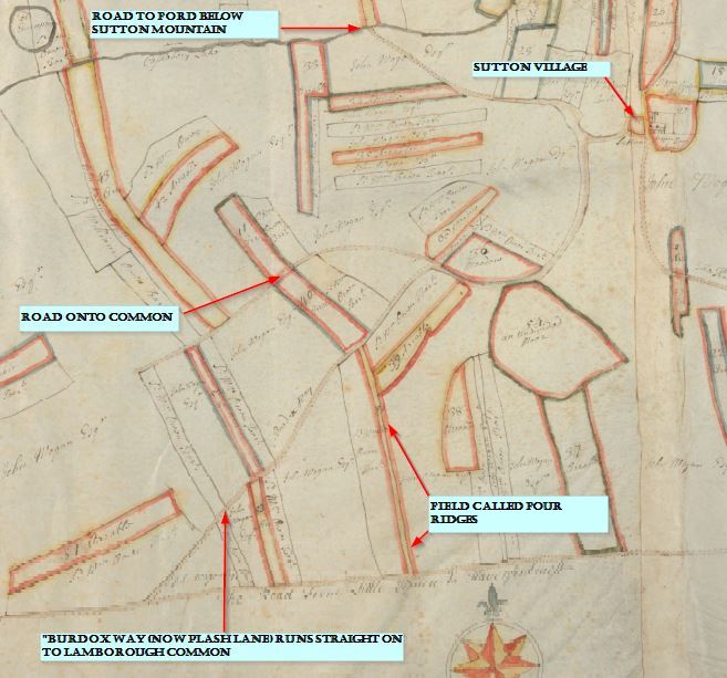
A conveyance from the eighteenth century described it as the road from Sutton to Lamborough Gate. This indicated that the road had originally passed straight on to meet the Little Haven road at Lamborough Common. This was clearly shown on the 1762 Picton Estate map. That map showed the lane as named ‘Burdox Way’. Again this is a name that I have not been able to find in any other documents. MAP
Lambston
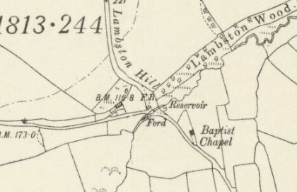
The hill up to Lambston from the Sutton – Nolton road is known as Lambston Hill on the larger scale O.S. maps. The map below shows a widening at the lower part of the road. This may have been associated with vehicles making new routes up a steep, wet route and widening the route.
Neither that road beyond Lambston towards Pelcomb, nor the lane which cuts back to the Nolton road behind the church are named as far as I know.
A small piece of land west of Lambston village leading north is shown on the Tithe Map as ‘Old Road’ – this does not seem to go anywhere and presumably served as a field or cottage access.