What links Lambston with St Davids, Little Newcastle, Carew and St Petrox? – Bounty Land
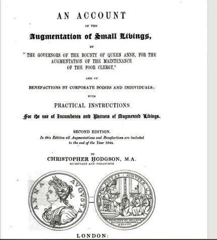
The name ‘Bounty Land’ sounds a bit like an advert for a chocolate bar. When David Marr from West Hill Fold Farm brought me a map with the name on it, I had no idea what it meant. It turns out that it was farmland purchased by the Commissioners of Queen Anne’s Bounty and then let; the income to help support local churches.
In 1704 money originally collected from parishes to be paid to the Pope and which, after the reformation, was paid to the Crown, was reallocated to fund this ‘Bounty’. In the eighteenth and nearly nineteenth century the funds were used to buy £200 worth of land and the income was then allocated to parishes where the tithe income was not enough to support the parish church.

The Tithe Map of 1840 – Bounty Land for Dale and St Petrox Parishes
The Tithe Map in 1840 showed two area of land as ‘Bounty Park’, owned by ‘Dale Bounty’, mainly within the square made up of the two lanes to Sutton and Mount Lane. It also shows a single field at Portfield Gate called ‘Broadwells’ as owned by St Petrox Bounty.
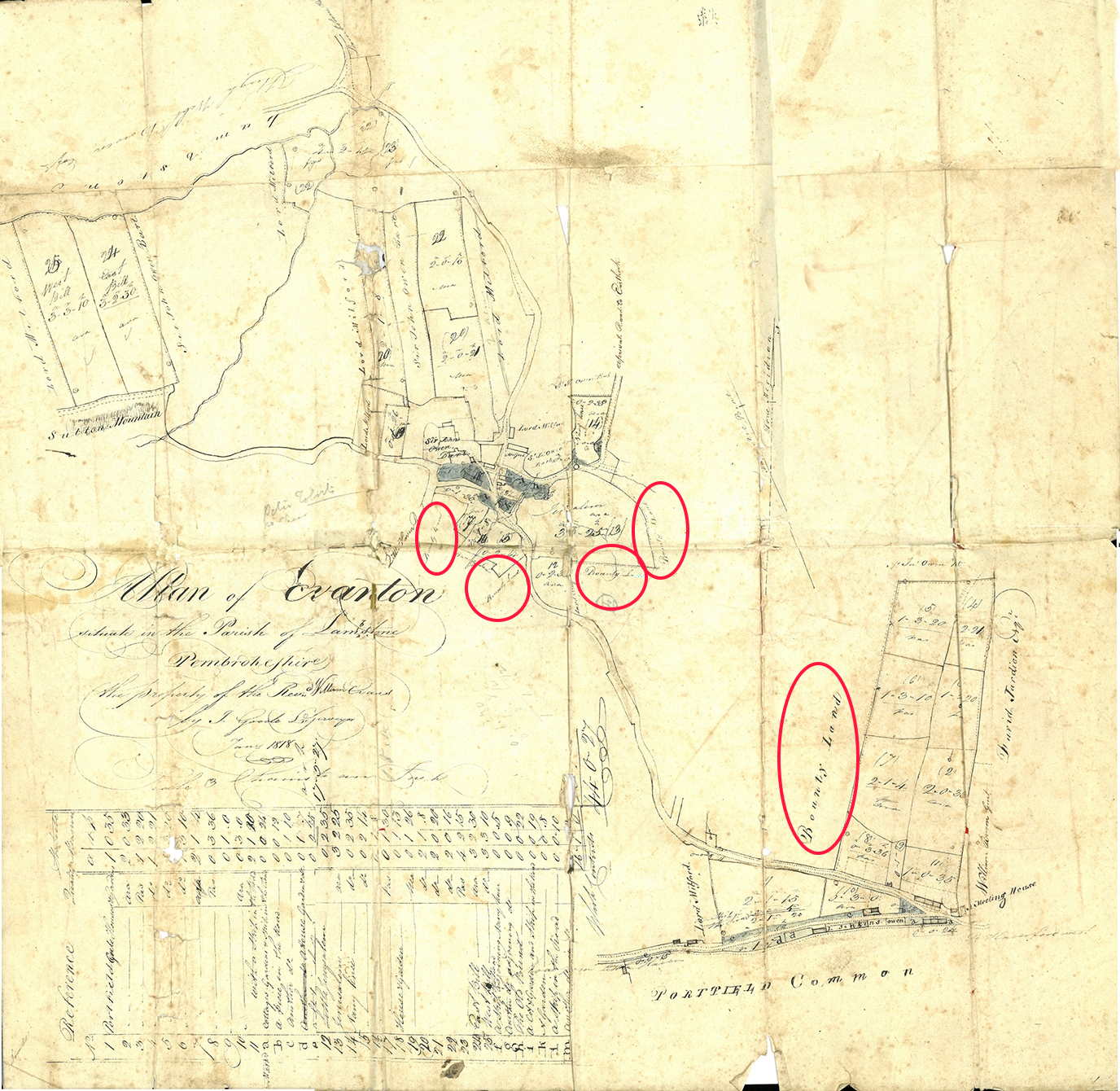
The map provided by David Marr shows some of the Dale Bounty Land and Broadwells. It also shows Bounty Land closer to West Hill Fold in Sutton. From old conveyances it seems that this land was purchased by the Commissioners of Queen Anne’s Bounty. The previous owner was John Summers. It was purchased in 1784 and 1785 by clerics from Carew parish and the Curacy of St Davids.

So now, we have land in the parish of Lambston purchased by the Commissioners and let to benefit Dale, St Petrox, Carew and St Davids.
Bounty Land for Carew and St Davids
In 1840 the two pieces of ‘Bounty Land’ near Westhill Fold are shown as owned by two Reverend gentlemen. A bit more research shows that The Rev. William Thomas was rector of Carew and the Rev. William Richardson was at St Davids. So the land was still in the ownership of those parishes even though they are not mentioned. In 1859 the St Davids land was sold by William Richardson and 1661 the Carew parish sold their land. Both were sold to James Eaton-Evans. (Conveyances and references in papers from David Marr).
There was one oddity of the picture of land ownership on the tithe map. Because as well as being listed as the owner of the Bounty Land at West Hill Fold, the Rev. Richardson also owned Gabriel Farm.
Bounty Land for Little Newcastle
Then a legal document from a court case in 1839 emerged. This showed that there was also land in Lambston, which was acquired for the benefit of the parish of Little Newcastle. It had been purchased in 1791 from William Summers who had also sold the land described in the previous paragraphs at West Hill Fold.
The case stemmed from a disagreement about whether the vicar could let the land in an agreement that ran beyond his death without the agreement of ‘The ordinary’ – perhaps the Bishop. The land was not defined, but was in occupation of a David Evans from 1800. It consisted of “a messuage, dwelling house, and garden with the appurtenances…. And also all those two closes situate etc. in the parish of Lambston”.
There is no record on the tithe map (1840) of any land owned by the parish of Little Newcastle. Nor is there any mention of the cleric in the case, James Rees as a landowner. Nor any tenant called David Evans. There was however a David Evans who was the tenant of Gabriel Farm. he appeared in the Lambston Parish Burial Register in 1832.
Can we link Gabriel Farm with Bounty Land?
If David Evans at Gabriel was the tenant in the legal case, then perhaps the Bounty Land for Little Newcastle was at Gabriel Farm. After James Rees died in 1835 his successor, who was bringing the case, was a Peter Davies Richardson. I wonder if his father was the ‘William Richardson’ on the tithe apportionment as owner of Gabriel. Certainly they had a link. Because in 1843 William preached at the service to celebrate the re-opening of Little Newcastle church after its restoration by Peter.
Bounty Land for Lambston Parish
When I first heard about land held to support the church I had rather assumed that land in Lambston to support Lambston Church. But this was not the case. Lambston did receive support from Queen Anne’s Bounty. The Genuki website on Lambston quotes Lewis’ Topographical dictionary from 1833
“LAMBSTON, a parish in the hundred of RHÔS, county of PEMBROKE, SOUTH WALES………..The living is a perpetual curacy, in the archdeaconry and diocese of St. David’s, endowed with £200 royal bounty, and in the patronage of the Master and Fellows of Pembroke College, Oxford. “
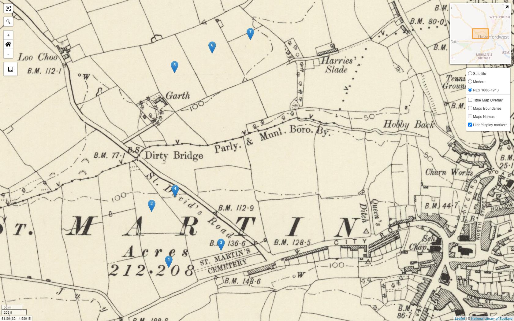
The Bounty Land for Lambston was in the parish of Haverfordwest St Martins. It lies roughly between the St Martins Road cemetery and where the new Redhill School is today. It was in the name of the Lambston Rectory and was rented to three different tenants. One of these was John Jenkins. Someone of the same name owned land near Providence in Lambston.
