Woodland in Lambston Parish
Tundra to Forest
Go back 12,000 years in this area and you would find no woodland, just a treeless tundra. Where Lambston is now is just south of the extent of glaciation. Go back 8,500 years and you’d have woodland spreading in from the south and east and reaching an almost complete cover by 6,000 BP. This was the period when people came back to Pembrokeshire. We have settlement remains and a flint factory from the Mesolithic only 8 miles away at Nab Head.
Early Reductions in Woodland
Linnard (2000) suggests a decline in woodland across Wales from the Bronze Age to around an 80% cover. Woodland cover reduced at a steepening rate in the Iron Age and this continued right up to the 1800s. We don’t know anything about the specific mix of vegetation in Lambston. In general you might expect a Birch and Scots Pine cover early on. This would turn gradually to an Oak wood with Elm, Hazel, Ash and Lime, with Alder and Willow in wetter areas. Gradually the amount of Pine and Birch would be expected to decrease. Sycamore and Beech were introduced species, perhaps from Roman times, probably later.
We have a record of an occupied site at Walesland Rath in Lambston as early as the second century BC. The Dyfed Archaeological Trust identifies four settlement sites or raths provisionally dated to the Iron Age in the parish. However, it is likely that a lowland area like this may have been settled earlier. Woods would have been cleared by ring barking and fire as well as by felling. Introduced grazing animals would restrict woodland regeneration near to settlements.
It is likely that the percentage of woodland in Lambston area has been low throughout recorded history. There are no woodland-related farm names and no apparent record of woodland management activities of any scale.
Historic Woodland Evidence
Pembrokeshire had a low percentage of tree cover as early as the sixteenth century. What woodland there was mostly focussed in the north. Written sources mention the Gwaun Valley, Pengelli, the Daugleddau, Canaston and Narberth, but no woodlands are mentioned around Lambston.
J. Leland writing in the sixteenth century in ‘The Itinerary in Wales’ recorded that Pembrokeshire was ‘somewhat barren of wood’. He identified the major causes of deforestation as uncontrolled felling, browse damage and deliberate felling.
In 1763 a shipwright building ships in Neyland complained: “So effectively is this county stript of navy timber that we are not able to produce so much as a futtock to put in her”. Linnard p 98.
Nineteenth Century Records of Woodland
The first Ordnance Survey maps in the early nineteenth century do not show any woodland in the parish but this is probably because they are at such a small scale.

Woods on the Tithe Map
By 1840 when we have the first complete land-use record in the tithe maps, the proportion of woodland was very low. Only 8 plots totalling a little over 17 acres are scheduled as woodland (0.17% of the parish area) . For comparison the present day woodland in Wales (One of the lowest in Europe) is around 15%. Both Lambston Wood and East Hook Woods are shown as wooded in 1840.
Late Nineteenth Century
Established Woods
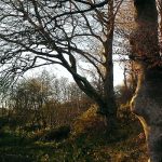
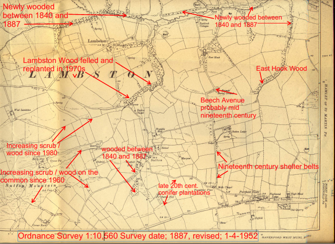
By the time of the 1:10,560 Ordnance Survey in 1887 there were only two named woods in the parish. These were Lambston Woods to the South and East of Lambston in the valley. Also in a stream valley, the second wood was on the parish boundary at East Hook.
New Plantations
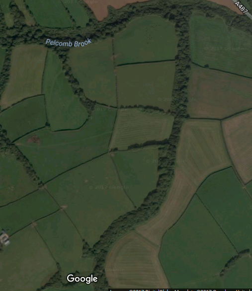
A small newly-established mixed plantation was shown just south of the two Honey Hooks. The valley below Lambston Hall was shown as wooded, as were two of the north-south valleys at Walesland. The more easterly of these two was shown as a mixed wood of deciduous and conifer trees suggesting a planted wood. Another new conifer/deciduous shelter belt, was shown parallel to the Pelcomb Brook ending at Walesland Rath.
Towards Portfield Gate, a very small conifer plantation had been planted on land just south of Sutton Lodge. There were also very narrow shelter belts along Mount Lane. Newly planted mixed woodlands are shown on the roadside at Westhill Fold Farm and below Sutton Hill Farm. None of these are large woods but there had clearly been an interest in planting between 1840 and 1887.
Twentieth Century Woodland
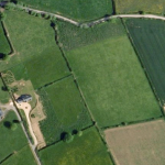
Managed Planting
All of the wooded areas shown on the 1885 survey remain wooded today. There are also two new plantation areas at Sutton Hill Farm. Oddly the OS has moved their label for ‘Lambston Wood’ from the West (Lambston) side of the brook to the East Hook side. I am not aware of active woodland management anywhere in the parish, probably there is some in the recently planted areas. Some of the shelter belts and even the established woodlands are now very decayed and in need of management and probably planting.
Lambston Hall has planned a programme of planting for winter 2020-21.
Scrub and woodland encroachment
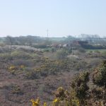
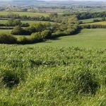
There are however more areas of scrub woodland along the valley of the Pelcomb Brook and its tributaries and an increasingly wooded scrub area on Sutton Mountain Common following the withdrawal of grazing. It is probably true to say that the land is divided much more sharply between highly improved farmland and land which is unmanaged and reverting to scrubby woodland.
It is hard to define where woodland starts and scrub ends but it may well be the case that there is a greater area of woodland in the parish today than at any time in the last 200 years.