The Farmed Landscape
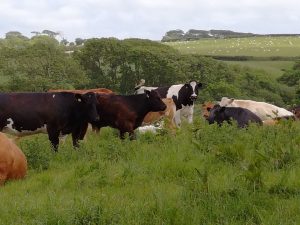
The core of Lambston Parish in terms of landscape and human activity has always been farming. Farmed landscape dominates the view from any point in the parish. What non-farmed land there is (small areas of woodland, common, settlements and roads) is set within that farmed landscape. This has been the case for centuries (probably for millennia) and beyond a few quarries and gravel pits virtually all of the landscape features are related to agriculture. Most older dwellings, even apart from farms, were occupied by farm labourers until the mid or late nineteenth century.
Sutton in 1762
Farming in 1840
The first complete record that of ownerhip and use of farmland is given in 1840. This comes from the combination of the Tithe Map and the Tithe Apportionment. These maps and lists were produced to allow the traditional tithe of farm produce to be converted to a monetary value and are completed in considerable detail. The Apportionment document details 40 land holdings of over 1 acre in the parish owned by 16 landowners.
The largest holding (East Hook including Little East Hook) amounted to 197 acres. Executors of John Lort Philipps owned it and John Freeman was the tenant, with John Greenish at Little East Hook. There were four other holdings greater than 100 acres, three between 50 and 100 acres. Smaller units included thirteen holdings between 20 and 50 acres and another eight between 10 and 20 acres.
The North-South Divide
What was particularly striking in 1840 was the difference between the north (Lambston and East Hook) of the parish with four big and compact blocks of ownership and the south of the parish (Sutton).
- In 1840 out of 16 Landowners, 5 are in the northern half of the parish, 11 in the south.
- Four of the five largest landowners in the parish are in the northern half.
- All five of the northern landowners own their land in discrete solid blocks.
- No-one, who owns land in the south, owns land in the north
- Of the larger southern landowners (over 50 acres), all own their land in multiple scattered fields.
This suggests a very different history of landownership between these two areas even though both areas have landowners who own the land as part of much larger holdings across the county (e.g. Charles Bowen (Camrose Estate) and John Lort Phillips (East Hook) and Sir Richard Phillips (Picton Estate).
Early Farm Names
Most of the farms in the north have names that first appear before 1700 – ‘East Hook’, ‘Waseland’, ‘Honey Hook’, ‘Lambston’. In the south only ‘Sutton’ is in use pre-1700 as a place name. Farm names for farms based in villages do not seem to emerge until the nineteenth century. Reference is usually made to ‘my land of Sutton’ or simply to ‘Sutton’ as a location rather than as a farm name.
That may suggest that the north farms were the demesne (Manor) farms under the much earlier manorial system based at Camrose or Roch Castle. While the southern land was mainly open field that was later enclosed?
A significant number of farms were abandoned between 1840 and the present day. For more information this link will open a new tab

Link to table.
There is a valuable website that shows all of the tithe maps in wales together with their apportionments at http://cynefin.archiveswales.org.uk/
Please Note; This website is under construction and the research to support it is ongoing. If you have useful information or can correct any errors, please let me know.